
Early access · iOS & Android
Navigation for when GPS fails
NavShield notices when GPS is jammed or spoofed and keeps guiding you — from your phone’s sensors and the road map. No made-up metres: the screen always shows how sure the app is.
- Driving and walking
- Map of all Ukraine
- Guidance without a network inside the corridor
- Anonymous account
- GPS fixes under jamming
- NavShield’s position
- Route
What electronic warfare breaks
GPS says you’re in the river. NavShield knows you’re on the road.
Electronic warfare systems jam and spoof satellite navigation signals. A typical navigator doesn’t notice — and obediently shows a wrong point.
-
The position jumps
Under spoofing, the phone receives fake coordinates. Your dot lands in a river, another city or another country, and the route gets rebuilt to nowhere.
-
The position freezes
Under jamming, the signal disappears. The dot sticks while you keep driving, and turn prompts come late or stop altogether.
-
False confidence
Worst of all, a wrong position is shown just as confidently as a correct one. There’s no way to tell whether you can trust it.
- GPS fixes under spoofing
- NavShield’s position — on the road
- Route
A diagram on a real map of Kyiv. It illustrates the principle; it is not a recording of a trip. © OpenStreetMap contributors · Protomaps
Interference occurs in many regions — not only near the front line.
How it unfolds
What happens when GPS is jammed
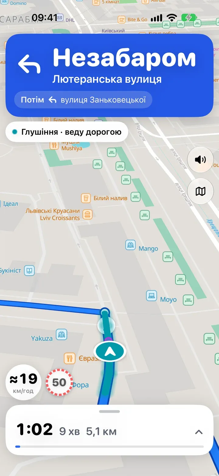
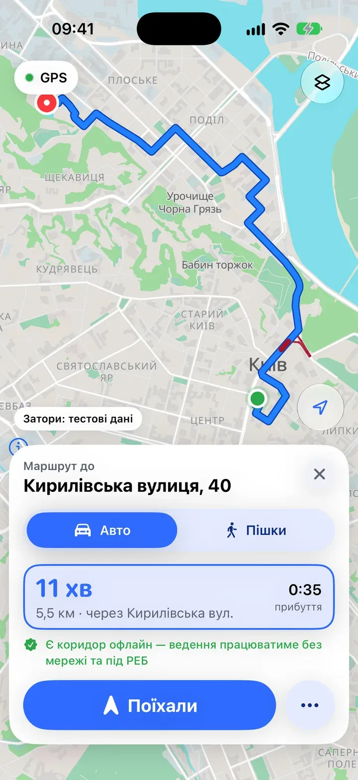
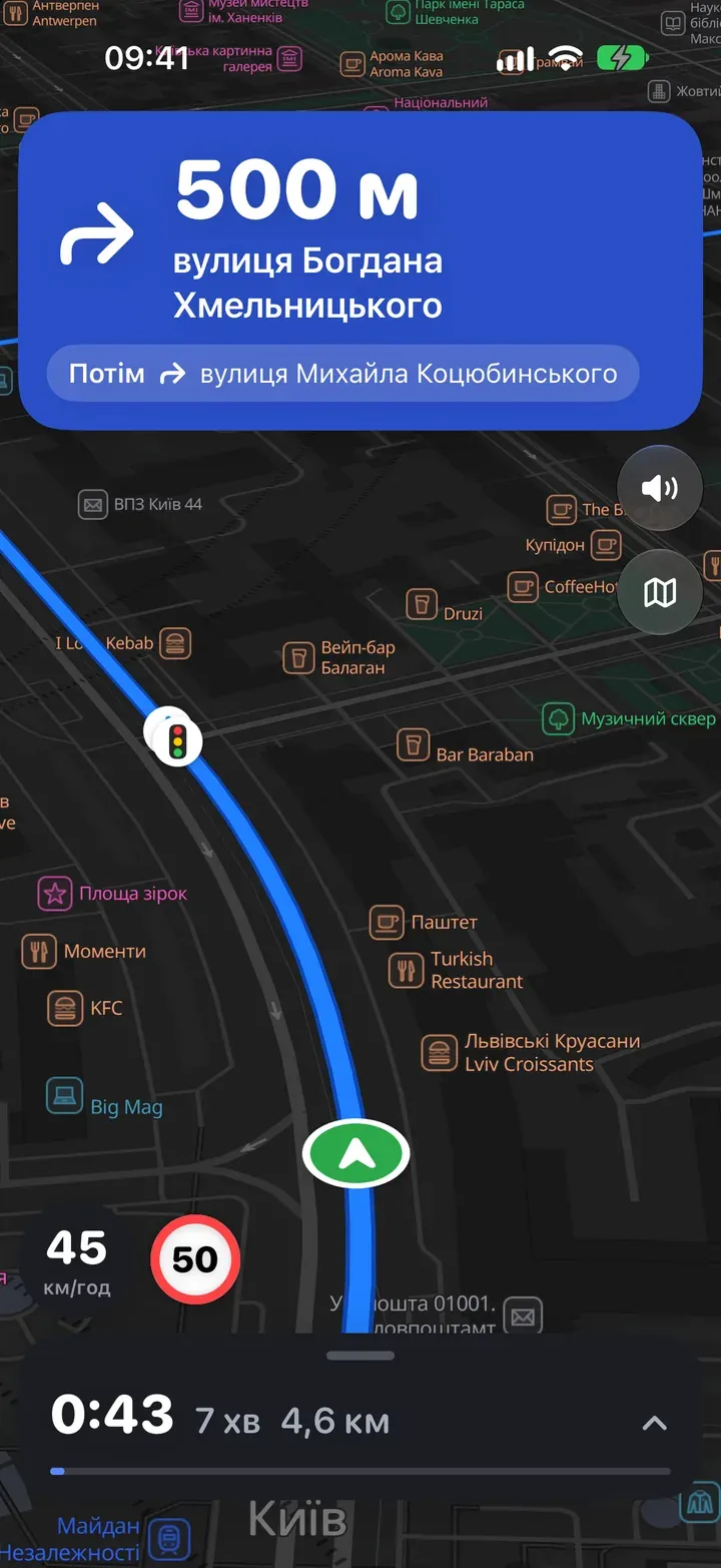
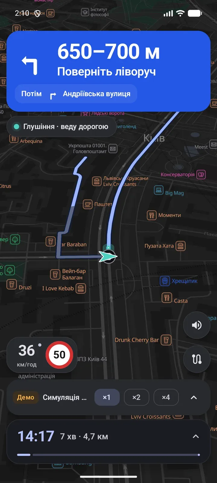
Four frames from the real app: from a healthy signal to an honest question.
-
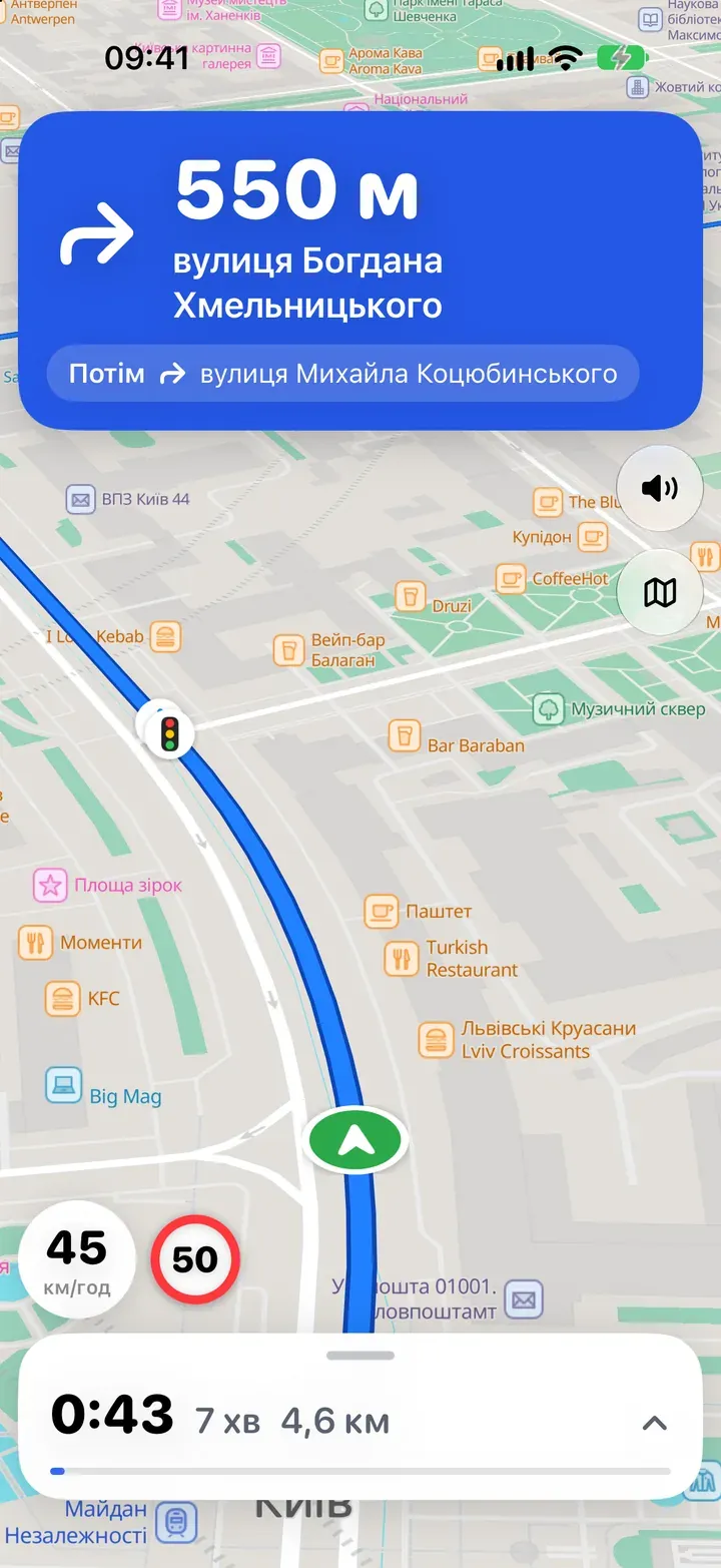
Precise
GPS is healthy
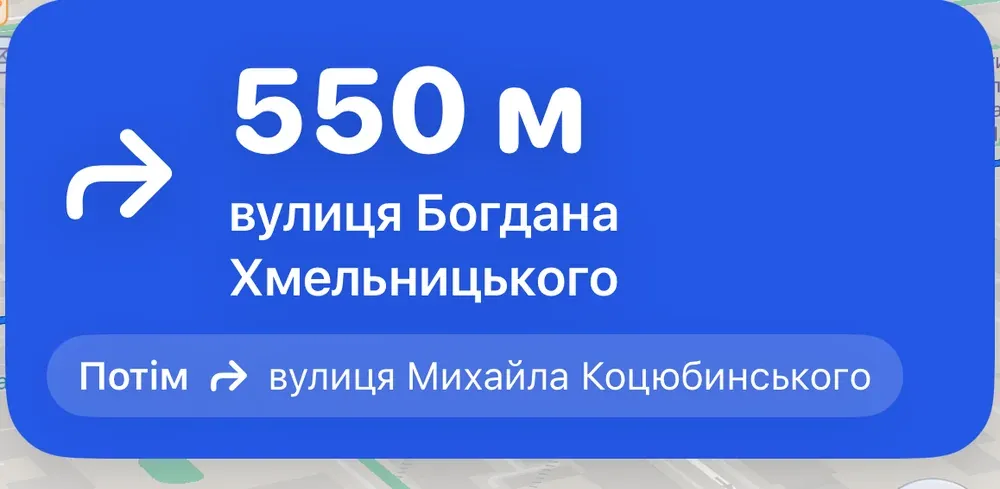
Ordinary navigation with exact distances: “550 m, Bohdana Khmelnytskoho street”. Meanwhile NavShield is already checking the signal against how the phone is moving.
-
Road-locked
Jamming — following the road
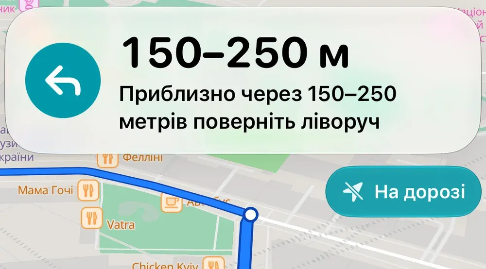
The signal became unreliable. NavShield stops trusting it: the road and the route define the position, and “Soon” or a distance range replaces exact metres.
-
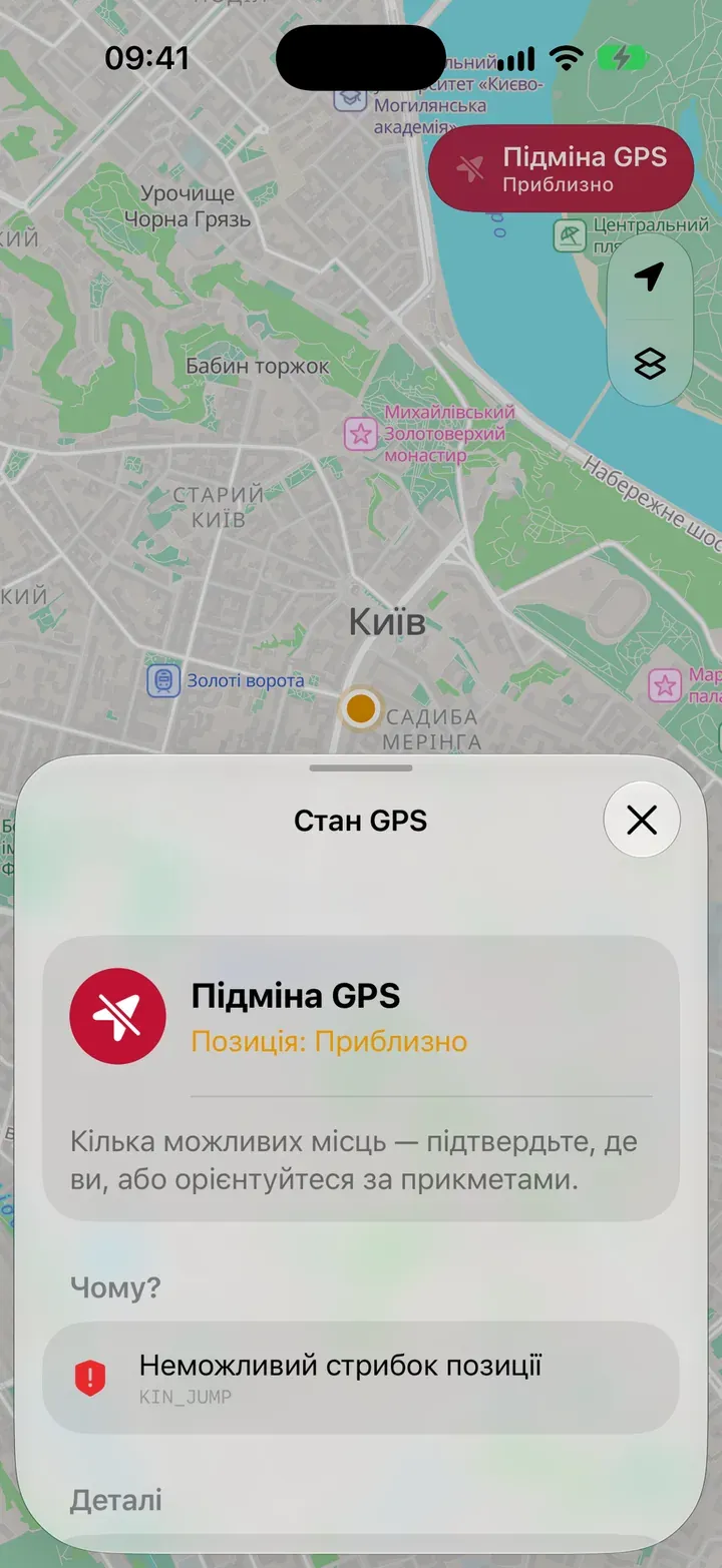
Approximate
Spoofing — and why we think so
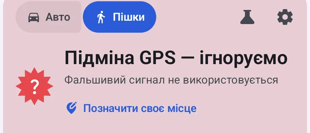
If the position jumped impossibly far, the app doesn’t stay silent: it shows the reason — “Impossible position jump” — and doesn’t use that point.
-
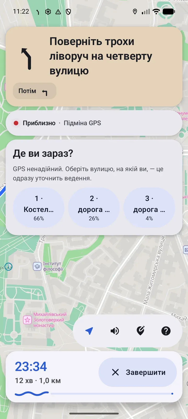
Approximate
Not sure — it asks
When several places are possible, NavShield shows the options: “Where are you now?” You pick the street or mark yourself on the map, and the Anchor restarts from there.
Screenshots from iOS and Android (early-access build). The interface may change.
The principle
Not a dot on a plane, but a place on a road
Instead of guessing coordinates, NavShield locks onto the road network and the planned route. A position is a place on a specific road, not a point out of nowhere.
-
Integrity check
Every GPS fix is tested for plausibility: impossible jumps, unrealistic speed, disagreement with how the phone is actually moving. On Android we also analyse satellite signal strength and quality.
trusted → suspect → jammed / spoofed
-
Phone sensors
The accelerometer, gyroscope and compass tell us how you’re moving. Driving speed comes from cornering physics — lateral acceleration divided by turn rate — and on foot we count steps.
v = a / ω
-
Road lock
Hundreds of hypotheses travel along the road graph and your route. Every turn, a road’s distinctive curvature — like a fingerprint — and every stop at a traffic light weed out the wrong ones.
turns · curvature · stops
-
Honest confidence
NavShield tells you how sure it is and adapts its instructions to match. When it doesn’t know, it says so and asks you to mark your spot on the map.
4 confidence tiers
Honesty
Four confidence tiers
Instructions change with what NavShield actually knows. No made-up metres when nobody really knows the exact distance.
Precise
GPS is healthy and the signal is verified.
Ordinary navigation with exact distances.
A single point on the road
Road-locked
GPS is unreliable, but the road is known, and roughly where on it.
Distance as a range: “150–250 m”. A “On road” badge.
A stretch of road
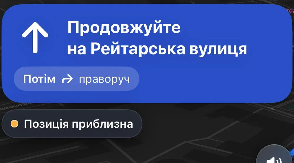
Approximate
Several places are possible, or the stretch of road is too long.
Instructions without numbers: “Continue”, captioned “Position approximate”.
Several possible places
Unknown
Not enough data to honestly say where you are.
No invented dot. NavShield asks you to mark your spot on the map.
Unknown
Tiers and wording come from the current build and may change. Real-world accuracy under electronic warfare hasn’t been measured in the field yet — so the app doesn’t promise it, it shows it.
No network
Route corridor and offline maps
The server usually computes the route. Along with it, the phone receives a compact “corridor” of roads around the route — so guidance continues even when both GPS and the network are gone.
-
Corridor
A sub-graph of roads along the route is stored on the phone. Guidance and rerouting inside it need no network.
-
Offline region
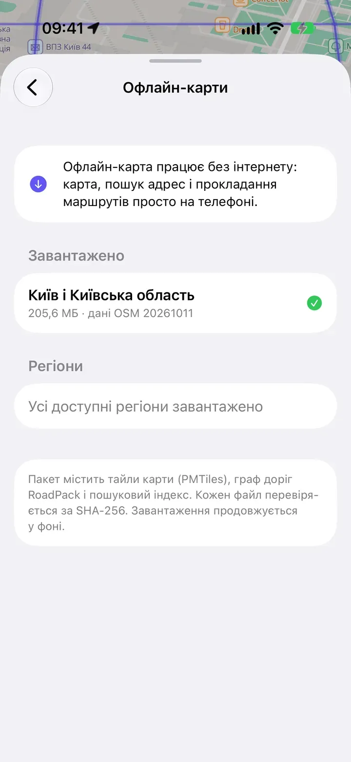
Download an area in advance: the map, address search and routing inside it keep working without the internet.
-
Verified data
Every region file is checked against a SHA-256 checksum before it reaches the app.
- Road corridor stored on the phone
- Route
A diagram on a real map. The corridor width is shown schematically. © OpenStreetMap contributors · Protomaps
Platforms
Native on iPhone and Android
Not a web wrapper, but two truly native apps — Swift on iOS and Kotlin on Android. Each speaks its platform’s design language and talks to the sensors directly.
Driving
- Speed from cornering and acceleration physics, even when GPS goes quiet
- Stops at traffic lights and crossings become landmarks
- Respects one-way streets and turn restrictions
- Instructions like “after the traffic light, turn left”
Walking
- Speed from your steps — NavShield learns your stride while GPS is reliable
- Sidewalks, footpaths and crossings
- Compass and gyroscope keep track of direction between turns
- Routes avoid motorways
Privacy
Your data, under your control
We only ask for data when it genuinely helps make navigation better — and we explain why, plainly.
- Account
- Anonymous by default: no name, email or phone number. Sign in with Apple, Google or email later if you want sync.
- Trip recordings
- Only with your consent: GPS fixes, motion sensor data and how the route went. We use them to improve the algorithm. You can withdraw consent at any time.
- Deletion
- In the app or on request — we remove your data from our servers.
- What’s always needed
- Technical server logs with IP addresses — to protect the service from abuse — kept for 30 days. Usage analytics and crash reports go through Firebase; analytics can be turned off.
- Where it’s stored
- Google Cloud in the EU — Warsaw. Raw sensor data — up to 12 months.
- Selling data
- We don’t.
Questions
Frequently asked questions
What is NavShield?
A native navigator for iPhone and Android — for driving and walking, with a map of all Ukraine. The key difference: NavShield detects GPS jamming and spoofing and keeps guiding you along the route using your phone’s sensors and the road map, while honestly showing how confident it is.
Does it work without internet?
Partly — and it’s best to prepare in advance. Routes are normally built on our server, so that step needs a connection. But along with each route, your phone downloads a compact “corridor” of roads around it: if the internet drops later, guidance and re-routing within the corridor keep working.
For fully offline use, download a region’s offline map — then the map, search and routing inside that region work without a connection.
How accurate is the position under jamming?
It depends on the situation — and we don’t hide that. Accuracy depends on the time since the last reliable fix, the number of turns and stops, how dense the surrounding roads are, and whether you’re driving or walking. The more “fingerprints” the route provides, the more firmly the Anchor holds your position.
That’s why NavShield always shows its confidence tier — Precise, Road-locked, Approximate or Unknown — and adapts its instructions to it. If the app doesn’t know where you are, it will say so.
How does NavShield detect jamming and spoofing?
The app constantly compares GPS with what the phone’s sensors feel: does the position jump impossibly far, do speed and direction match the motion, have you suddenly ended up off-road or outside the country? On Android we also analyse satellite signal strength and quality.
NavShield doesn’t use suspicious fixes to determine your position, and only goes back to GPS once the signal is stable again and consistent with your movement.
What if NavShield gets it wrong?
Tap the map and mark “I’m here” — the Anchor restarts from that spot. When the app is torn between several roads, it shows you the options so you can pick the right one.
Do I need an account?
No. An anonymous account is created on first launch. Later you can sign in with Apple, Google or email to sync saved places across devices.
What data do you collect?
Without your consent, only what the service needs to work: route and search requests, and technical server logs including IP addresses (kept for 30 days). Usage analytics and crash reports are collected via Firebase; analytics can be turned off.
Trip recordings — GPS fixes, motion sensor data and route outcomes — are uploaded only if you allow it. They help us improve the algorithm. See the Privacy Policy for details.
Does it work for walking?
Yes. On foot, NavShield counts your steps, learns your stride length while GPS is reliable, and routes you along sidewalks and footpaths.
Does it drain the battery?
Like any navigator with the screen on, NavShield uses a noticeable amount of battery. Motion sensors themselves are frugal, and we keep optimising the heavier computations. During the beta we’re watching energy use closely and would love your feedback.
How do I get early access?
Leave your email in the form below and choose your platform. We’re inviting testers in waves and will email you a link to the test build for iOS or Android.
Beta
Get early access
The beta is coming to iOS and Android. Leave your email and we’ll send an invite as soon as there’s a spot for your platform.
You can unsubscribe at any time — just reply to the email.
Thank you — you’re on the list.
We’ll write as soon as your invite is ready. If it doesn’t arrive, check your spam folder.